

|
Lower
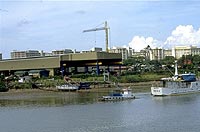
reach of the Pandan River [Figure 11aold and fig 11bnew] Under Construction As most of “larger” rivers in Singapore, the Pandan River was dammed near its mouth. The Pandan Reservoir was created as part of the Kranji/Pandan Scheme, one of the two major water supply schemes completed in 1975. This scheme comprised Kranji Reservoir, which was created by damming the estuary of Kranji River, and Pandan Reservoir, by building a dyke (Plate VIII) to enclose an area which used to be a mangrove swamp and is now converted into shipyards and light industries along the west coast highway (Plate IX). The Reservoir provides water for domestic and industrial use. As other reservoirs in Singapore, the Reservoir is characterized by shallow depth and large surface area (implying higher water loss by evaporation). Garbage like debris and plastic bottles & boxes has been trapped by pollutant traps (Plate X) as we saw in the video clip (Clip 1). To View clip 1, Click HERE.
|
||||||
 .:: Plate X ::. |
|||||||
| Developed by Centre For Instructional Technology, NUS © 2003 | |||||||
![]]] CASE STUDY [[[](images/but_csstd_up.jpg)

